It really is a good thing my mother hasn’t asked how we’re going to call for help yet. I’ve got to figure it out for myself first. Here’s where the whole wilderness thing really starts to sink in for me.
When I think of being in the wilderness I imagine standing alone, embraced by mountain peaks, enjoying endless vistas, no pesky humans or cell phones to interrupt my communion with nature. But somehow in the back of my mind there is still the assumption that if I broke my leg, a helicopter would miraculously appear and gorgeously fit men and women with loads of life-saving gear would whisk me away to a well-equipped hospital in no time flat.
This is the first of what I am sure will be many assumption adjustments. Not only will we be hundreds of miles from the nearest town, but there are absolutely no roads or human trails or helpful signs in the Refuge at all. The only access to the Refuge’s 19.3 million acres (30,000 square miles!) is on foot, by plane, or by boat. If something were to go wrong, help would be days away at best and totally dependent on good weather allowing the search and rescue team to reach us.
OK, I say calmingly to myself, let’s just take this one issue at a time.
First, if something were to go wrong, are we as a group prepared to handle it ourselves?
Time for an email survey of the Expeditioneers. Turns out Fran was an army medic and had annual trainings in wilderness first aid while he was with the Fish and Wildlife Service, Bill had similar training with the National Park Service, and Rick has had some too. But I can’t just rely on everyone else, and they need to be able to rely on me. So I’ve signed up for a National Outdoor Leadership School Wilderness First Aid course. The instructor told me it would be like drinking out of a fire hose for two days, and the pre-course materials warned me to be prepared to either lie on the ground pretending to be injured or to care for the “wounded.” Either way I should wear clothes that won’t be ruined if they get covered in fake blood.
Second, if something happens that is truly life-threatening and we can’t handle it ourselves, how are we going to request evacuation for the injured?
I sent another email to Fran and Jeff. This is getting better all the time! It turns out we’re bringing an Iridium satellite phone. Yep, you heard me – a satellite phone. Cool. The Marine Magnum shotgun was very Bruce Willis. A satellite phone just screams James Bond. Fran says he will train each of us on the use of the phone before we leave Coldfoot.
That still doesn’t answer the location question, though. How are we to know exactly where to tell the rescue crew to find us?
I know when Bill goes backpacking alone, he uses a device called Spot. It’s a small transmitter that sends a signal once a day via satellite to a pre-determined set of email addresses. It sends your GPS coordinates and one of three messages, depending on which button you push: 1) All’s well 2) I’m going to be delayed to the pickup point, or 3) Emergency response required.
But I don’t know whether that will work. I’ve read that satellite navigation for shipping above the Arctic Circle is very unreliable because of the ionospheric interference (yeah, I had to look it up, too). If massively profitable commercial shipping can’t rely on satellite navigation above the Arctic Circle, I have a hard time believing Spot will be able to send the correct GPS coordinates of our location, even if it can send the email message that we need help.
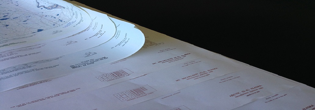
That’s where the maps come in. I ordered them, all 8 of the U S Geological Survey maps necessary to cover our route. I cut and pasted them together. When assembled, they measure 9 feet long! At 0.8 miles per inch, we’re travelling approximately 75 miles by river. That’s a lot of river. I suppose we can keep track on the maps of generally where we are by using landmarks like the peaks of the Sadlerochit and Shublik Mountains and the contours of the river, even if compass readings are squirrely and GPS unreliable above the Arctic Circle.
You want to know the best part about the maps, though? In the bottom right-hand corner of each and every one of them, it says
ROAD CLASSIFICATION
No roads or trails in this area
Assumption adjusted.